In 2024, a rail-trail conversion is hardly a novel concept. The likelihood that most Americans have never walked or jogged on one says more about our sedentary lifestyles than the trails’ scarcity. In fact, rail-trail conversions exist in all 50 states and continue to grow in both quantity and total mileage. Initially a tactic for breathing new life to long-abandoned, derelict rail corridors in urban settings, they have achieved growing salience in suburban and even rural settings. But it was a long time coming and required at least two decades of overcoming community apprehension or even outright opposition. The earliest incarnations of rail-trails—the Illinois Prairie Path and the Elroy-Sparta State Trail in Wisconsin—achieved limited recognition in the 1960s. But only in the 1980s, as railways companies merged and abandoned their less productive lines, did the notion of retaining the railway paths enter widespread public recognition. The Rails-to-Trails Conservancy (RTC), a nonprofit founded in 1986, initially focused on promoting railbanking, which recognizes the importance of long narrow rail corridors as viable tools for long-distance movement, either through eventually restoration of the railroad bed and reintroduction of trains, or through harnessing the trajectory of the railway a multi-use pedestrian/bike path. (Or maybe both.) Railbanking essentially precludes the alternative: carving the abandoned corridor into sellable units, most likely so that the adjacent property owners can expand their yards—a tactic that eliminates any possible reuse of the corridor, since the corridor is no more. In 2024, rail-trail conversions remain a common tool for introducing recreation and economic development: RTC estimates 150 networks are currently in planning or construction, and the last 40 years have witnessed over 40,000 miles of multi-use trail built along corridors formerly devoted to passenger and/or (mostly) freight rail. The Nickel Plate Trail in Fishers, Indiana offers as good of an example as I have seen of grassroots public support for rail-trail conversion.
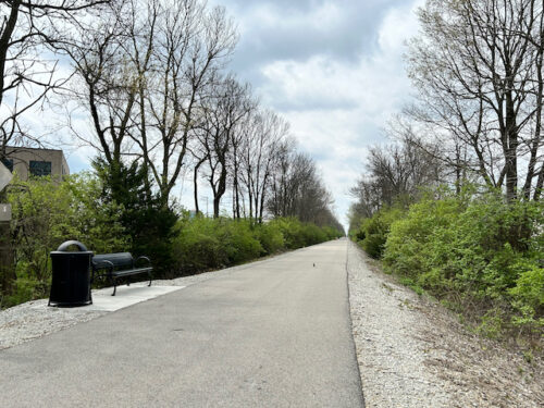
Turning to this affluent suburb northeast of Indianapolis, the photo above is hardly the optimal image to promote the Nickel Plate Trail, not because it’s inaccurate or unattractive; it’s simply undistinguished. Most rail-trail conversions look like this: a smooth asphalt path of about eight to twelve feet in width, resting on a bed of gravel, flanked by shrubs and taller trees, featuring the occasional amenity: usually a bench. It could be anywhere. Pivot the other direction, and the Nickel Plate Trail offers a tiny bit more interest…
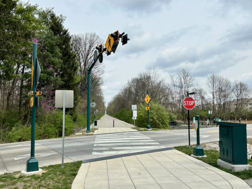
….but it’s still nothing striking. It’s the crosswalk where the Nickel Plate Trail intersects East 106th Street in Fishers, just a mile north of the municipal boundary between Fishers and Indianapolis and a mile south of Fishers’ downtown (East 116th Street). One can easily imagine what this would have looked like before the conversion, back when it was a neglected old railway. Or, if one’s imagination is still coming up short, all it takes is a quick trip to an archived photo from Google Street View, way back in July 2019. The repurposed Nickel Plate railway now links with sidewalks along East 106th Street in this rapidly urbanizing city, still legally defined as a town until 2015.
Its befitting that the City (formerly Town) of Fishers would accord such respect to the railway that earned the nickname “Nickel Plate Road”. The original rail company encompassed a robust network linking the major cities immediately south of the southernmost Great Lakes: headquartered in Cleveland, the privately financed line extended as far east as Buffalo, northwest to Chicago, southwest to Saint Louis, and south to Indianapolis, central Ohio, and Wheeling, West Virginia, amounting to over 2,200 miles at its peak. The initial name—the New York, Chicago, & St. Louis Railroad—ostensibly confused people, since it only extended into the edge of New York state; not the city. An Ohio newspaper, extolling the construction standards, referred to it as a “double-tracked nickel-plated railroad”, which reinforced the notion of heavy investment. The “Nickel Plate” name stuck.
Nickel Plate Road continues to function as a rail network, even though, in the decades since its 1964 merger with Norfolk & Western, many of the segments have closed. And though Norfolk Southern profitably manages some of the most lucrative freight corridors, the Indiana segment that linked Indianapolis to Michigan City (also in Indiana) is largely shuttered. A northern segment of Nickel Plate Trail that links Rochester to Kokomo uses the .org suffix; at 44 miles, it is among the longest uninterrupted rail trails in Indiana.
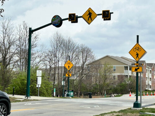
Confusingly, the much smaller segment of the trail passing through Fishers uses the .com suffix instead. At this early stage in development, it links Fishers to Noblesville just about six miles to the north; eventually it will extend southward to the Indianapolis municipal line, then continue well into some of the capital city’s inner neighborhoods. (It’s not clear if the Nickel Plate Trail will ever extend north of Noblesville, because from Noblesville to the small town of Atlanta, IN, an 11-mile stretch of rail lines operate as the Nickel Plate Express heritage railway.)
Right now, the most important function of the Nickel Plate Trail is to bolster growth and pedestrian-scaled development in Fishers’ nascent downtown, which it owes a great deal to the original Nickel Plate Road railway.
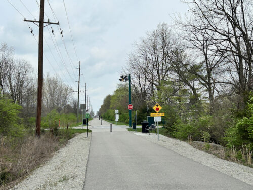
In fact, Fishers owes its very existence to the Nickel Plate Road when it was a thriving rail network. Originally (circa 1850) a stop along the Peru & Indianapolis Railroad called Fisher’s Switch, from what I can surmise, the New York, Chicago, & St. Louis Railroad company eventually purchased Peru & Indianapolis and integrated it within the Nickel Plate network. Fisher’s Switch morphed to Fisher’s Station, centering around the railroad’s intersection with 116th Street. But neither Fisher’s Switch or Fisher’s Station gained much traction and the post offices settled on “Fishers” by the early 20th century, at which point Fishers had blossomed to a staggering 138 people, with little more than a depot and a few commercial buildings amidst a latticework of streets totaling about eight blocks. It remained about the same in 1950, having only grown to 220 people. Even in 1970, Fishers only barely surpassed 600. But suburbanization caused the population henceforth to explode, growing at rates usually only witnessed in Arizona or Utah: 400% from 1990 to 2000. And, entering comfortably into the 2020s, Fishers has probably surpassed 100,000 people, nearing the size of South Bend.
And here’s what Fisher’s Switch looks like today at 116th and the Nickel Plate Trail (formerly the Nickel Plate Road):
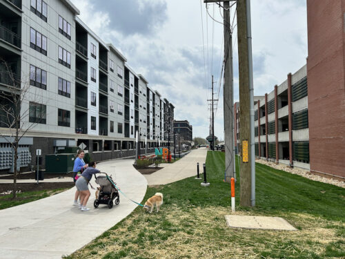
Note the utility line to the right of the trail, harnessing the linear passage established 175 years ago through the original installation of a rail line.
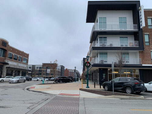

Fishers has begun asserting itself as a major suburban player, competing with the likes of the more-established Carmel to the immediate west. Downtown Fishers seeks to flourish as more than a cluster of municipal buildings, so developers are subsuming the farm estates and humble cottages that comprised its tiny “old town” area, making way for mixed-use office and apartment buildings with a walkable retail presence. It’s a work in progress, but these photos effectively capture the old and new downtown Fishers.


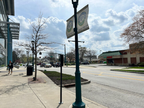
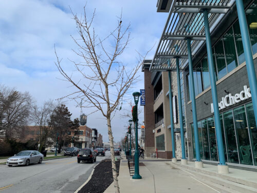
In the absence of a major north-south collector road to complement 106th and 116th streets (nearby Interstate 69 will never be pedestrian friendly), the Nickel Plate Trail serves as an instrumental pedestrianized corridor bisecting Fishers’ incipient downtown.
Most importantly of all, though: the Nickel Plate Trail represents a rail-trail conversion that has evidently achieved widespread community buy-in. How do I know? Just walking along the segment between East 116th Street and East 106th, and private landowners have responded accordingly.
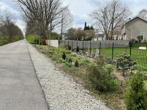
Although most homes that directly abut the Trail have some degree of security fencing or visual screening, many of them also have installed a gate with direct access to the trail. Notice the wooden fence in the background, with a gravel path linking the homeowner’s backyard gate to the trail where I’m standing. And then, in the foreground, with the wrought iron gate, the homeowner has invested into landscaping, creating an attractive and well-maintained display instead of the usual brambles that flank the trail (or the old railway). These efforts to aestheticize or improve access to the Nickel Plate Trail are likely to grow in prevalence as the years go by; keep in mind this trail conversion effort is less than three years old. I will concede that the NPT offers a privacy screening grant of $2,000 to adjacent homeowners, and it is possible that the properties in question took up the offer. But, operating within the grant’s stipulations, they chose to beautify, almost as though they have a new front-yard entrance due to the Nickel Plate Trail. Conspicuously absent were angry “DO NOT ENTER” and “NO TRESPASSING” signs.
My favorite effort to embrace the Nickel Plate Trail is a bit further down.

The homeowner in this case has financed benches and outdoor recliners. The white bench has painted some words of encouragement: “If you get tired, learn to rest, not to Quit.” The homeowners are actively encouraging passers-by to relax on their private property, as long as it directly fronts the Nickel Plate Trail. And if this effort seems a bit disheveled from the photo above, I will pivot to capture more.
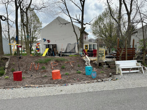
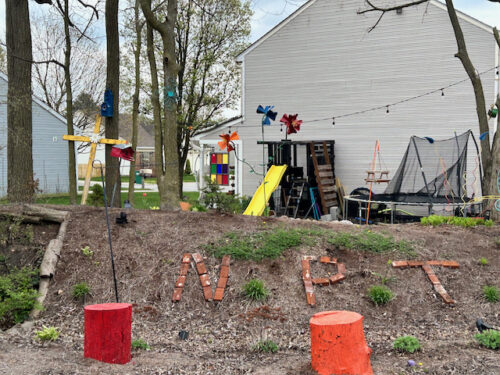
Okay, so it is a little disheveled. But it doesn’t look messy: just the sort of effervescent, free-spirited owner with an above-average fondness for bric-a-brac. We all know the type. And this one has spelled out “NPT” in bricks, to honor the path that separates the back yard from their neighbors’.
I’m sure the Nickel Plate Trail faced at least a mild squeak of opposition. They always do. And, since the segment is at this point still somewhat small, barely linking downtown Fishers to Noblesville, it doesn’t get hugely heavy use on a weekday at the lunch hour, as is obvious from the photos. But organized and intense opposition toward rail-trail conversions has largely receded in the last decade or so. The biggest argument was that converting an old railway into a multi-user trail would compromise privacy and safety for the properties nearby. All of a sudden, with a pedestrian easement slicing across the boundary line common to numerous private back yards, people would have joggers and cyclists coming through at any hour. This could have been true, but most municipal parks and recreation departments integrate rail-trail conversions into their portfolio of properties; the Nickel Plate Trail is no different, and while I’ll concede I don’t see hours listed, it is likely—to retain the community’s good will—that the City of Fishers enforces trespassing rules for visitors to the Trail at customarily unreasonable hours stipulated by Fishers Parks.
Most importantly, the prevailing question that adjacent landowners must ask: would it be better to remain as an abandoned railroad? These themselves can attract a criminal element, and the overgrown, overlooked nature makes it easier for illicit activity to take place undetected. I will concede that it’s a bit of a shame that the Nickel Plate Road’s train carrying capacity is all but eliminated (except for that tiny segment of the Express that links Noblesville north to Atlanta), but the transportation right-of-way still exists. Should demand ever rise for a commuter rail line linking Indianapolis to Fishers, Noblesville, Tipton, and Kokomo, the path is still there. It may be costly to reinstall track—potentially even as a “rail with trail” that preserves the multi-user path right next to a train line—but nowhere near as expensive as land acquisition.
The railbanking has paid off. For the time being, the Nickel Plate Trail endows this mostly auto-oriented boom-burb with a new amenity, all while helping to establish a downtown that basically didn’t exist fifteen years ago. It’s come a long way from the days of Fisher’s Switch. And maybe the future will usher in a Fisher’s Station.
ef1dec
81l8pc
s6r4ct
c8he39
pckv7c
opqo7r
1pjvm7
This is a fantastic and well-researched article — thanks for sharing such a thorough look at the Nickel Plate Trail and its place in the evolution of rail-trails across the U.S. What stood out most to me was how subtle and symbolic the gates, benches, and even landscaping gestures are — proof that this community doesn’t just accept the trail, but embraces it as part of their backyard identity. That brick “NPT” marker made me smile.