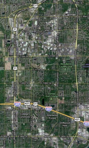
The Indyconnect proposal that is currently on the table makes no rail transit proposal for Carmel. Carmel is Indy’s largest and seemingly most prosperous suburb and has been making strides in recent years to tackle it’s long term suburban built form. These change have come in the form of a revitalized downtown arts district with a more dense built form as well as the recently completed City Center complex which is flanked by the Paladium, a large world class performing arts center. Carmel is rapidly adding citizens to it’s tax base which is also relatively low. Cycling has gotten a big boost with the large amount of off street trails mixed with some on street bike lanes. Indeed, Carmel is considered a bike friendly city. Carmel is also home to the Indy region’s 2nd largest concentration of jobs located along the US31 corridor on what could loosely be described as Carmel’s west side.
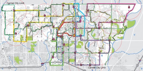
When Indyconnect’s final plan was adopted (short of funding for the time being), there was protest from Carmel’s Mayor Jim Brainard about the lack of rail transit serving Carmel. Indeed, with all the improvements going on in Carmel it stands to reason that their community would want a piece of the rail pie in the region. The logic makes sense too. The 2nd largest job concentration center in the region paired with the revitalized downtown area makes for a 1-2 punch of jobs & activity centers that could potentially be served with high quality rapid transit. Carmel was even first to the plate in revealing a circulator system for it’s town with a study that highlighted the need for what would start as a rubber-tire based trolley system that could later be replaced with rail streetcars. I reported on this study many moons ago and it generated a lot of buzz for & against. What it tells me is that people are passionate about this topic and it has some real teeth. The aforementioned circulator report also alluded to a regional rail connection that would thread through the north side of Indy to downtown via Broad Ripple along the way. I have already covered why Broad Ripple light rail to downtown should be the 1st rapid transit rail line in Indianapolis and backed it with job & activity center data to support my claims.
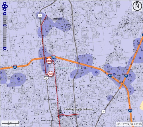
So why wasn’t Carmel included in rail discussion? If we were to opine about how the Broad Ripple route could interface with a Carmel route, what would it look like, and would it even be worth considering? I have drawn a map (see above) using data generated using data from the LEHD (longitudinal employer-household dynamics) website which is fed via US Census data. I have included a couple of potential ways in which it could trave l from my previous Broad Ripple light rail study to Carmel’s US31 job center. In my opinion, rail transit to Carmel has a lot of merit and I will attempt to explain why. I touched on this topic in a former post titled, “Why Route Matters“. At the heart, it makes sense to serve Carmel for the same reasons as it does to serve Broad Ripple. At the core, Carmel has become a job & activity center. These are probably the two largest reasons and form the basis for a strong argument in support of rail.Â
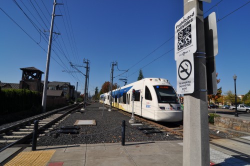
 One of the paradigms that American cities have to consider today, is the reverse commute. That is, the commute that city residents make to the suburbs for jobs every day. Serving suburban job centers is a difficult issue for regional transit based in part to their low density built form. It simply makes less sense to spend our scarce transportation dollars serving areas which offer small return on investment and in which a lot of the people simply do not want to ride a bus or a train. The aforementioned US31 job center however, makes Carmel an attractive destination for providing rail transit. One look at Google maps shows us the large glut of parking lots that these job centers attract and the automobile activity that accompanies these needs.
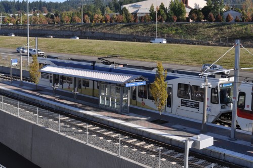
Indeed, we here at Urban Indy have been critical of an INDOT project currently underway to try and mitigate this which is coming in the form of the conversion of US31 from an urban highway to a full on limited access highway (freeway) that INDOT claims would open up the existing choke points. Converting a road to a freeway is simply one method that state DOT’s attempt to alleviate congestion. Will it actually cut down on idling car traffic and congestion? How many more people will use this freeway once it is completed? With little done to the surrounding surface streets to support the potentially increased capacity, will the problem actually be solved? Will Carmel be left to figure out what to do with this land in 20 years because new development is occurring 20 miles north? This is obviously one point of view, but the recent Census findings support the notion that people keep driving further to reach cheaper land at the expense of wear and tear on their cars and a larger budget for gasoline; and municipalities left to figure out what to do with the land. Indianapolis recently pledged to tear down over 2000 homes (at taxpayer expense) left vacant to the prior generation of suburban sprawl which has left these neighborhoods suffering from disinvestment. Will Carmel have to deal with this in 20 years itself?
I have not covered this topic in it’s entirety. I have not covered transit supportive land uses of which there are very few in the entire Indianapolis region right now. I have also not covered zoning changes, or exactly how light rail would be built; on existing roads or on the sides or medians. Could rail transit help to stem the sprawl paradigm? Probably not entirely. However, what it does do is provide focused transportation options to an area that currently experiences high levels of auto congestion, would eliminate a measurable percentage of vehicle emissions and would also provide cheaper transportation options to those willing to use it to get to jobs. In addition to this, land-use planning could be brought to bare and Carmel could fully embrace what has already started there which is a more urban built form. Furthermore, should a circulator system come to fruition in Carmel, it could be used to funnel lunch time workers or visitors to the downtown arts district or City Center providing an efficient, supportive, non-road clogging means with which to move people in and out of town. Carmel has displayed that it is working towards these goals. Rail transit makes sense for this region.
I agree. Carmel is doing a lot of things right. Circulator and light rail to the city make a lot of sense since Carmel’s density keeps increasing. I believe the newest higher density project is taking place on the northeast corner of 116th and College Dr, but there are more in the pipeline. It makes sense to me to first provide service to people living in the urban / suburban core, then provide longer distance routes to commuters (circulator before light rail). I would not be surprised if Carmel gets it done before Indy.
You know what would be a perfect place for a rail line between Carmel and Downtown that goes thru Broad Ripple? The Monon Trail! It’s almost like that space was put there to be trail tracks or something…
I don’t disagree with serving Carmel someday. I think the better route from Broad Ripple to Carmel is via Glendale and Keystone Crossing, as that connects combination employment/activity centers. North of Broad Ripple, Meridian is strictly residential up to 88th. Westfield is residential almost all the way to 106th (with a commercial node at 86th and an office node at 96th). Keystone, on the other hand, is an active commercial corridor all the way north from Glendale with one of Marion County’s largest non-downtown office clusters.
.
More specifically, I’d route the line to Keystone Crossing, then back across 96th (or along the north edge of the I-465 ROW) to Westfield/Range Line, then north to “downtown” Carmel. It could then go west to Meridian.
.
Again: this serves activity centers as well as job concentrations and would strengthen areas that are already relatively dense and intensely used. It would support and reinforce the actual “reverse commutes” that occur today. The proliferation of parking lots already at the nodes could serve “park and ride” users.
Just realized your route is College north. Westfield/Range Line and College have similar residential/commercial profiles north of BR, and the same argument applies vs. Keystone.
I’ve had a similar idea for a long, long time. The jobs centers on 31 and downtown should be connected, IMO. My ideal North-South line starts around Pennsylvania/Meridian at Main Street in Carmel, hops over to College at 116th, and runs down College Avenue past Mass Ave to Virginia. It then takes Virgina over to Shelby, then runs down Shelby past the University of Indianapolis, then turns onto Madison Avenue and goes south to Main St. in downtown Greenwood.
That line connects not only the two biggest business hubs in the city, but also the three biggest cultural centers. College Ave was built around the streetcar and presents a great opportunity for TOD, which the current plan to use the line up through fishers and noblesville does not do.
I don’t disagree that going up Keystone and past the Crossing would be beneficial, but it seems like a circuitous route for most. I would think a solution could be devised to take workers/shoppers to Keystone @ the Crossing from 86 & College.
Adam: Downtown Indy was built around streetcar lines on Illinois and Penn. The College line ran down Mass Ave. where it joined the 10th St. line to downtown. The line to Fountain Square ran down Virginia. There was no line on College (then called Noble) south of Mass Ave. [Source: 1899 “Bicycle and Driving Map of Indianapolis”]
.
Today’s employment and attractions are heavily biased west of Meridian. Rail on College through the urban core does not make sense, as it is residential and low-rise (small) office south of Mass Ave. The only exception is the backside of the Farm Bureau complex.
.
Contrast that with a route through downtown to FS via Illinois/Capitol and South to Virginia: they pass The Children’s Museum, Ivy Tech, Methodist Hospital, many office buildings, the State Government center, mall, Convention Center, LOS, new Rolls Royce offices, Lilly campus, CityWay, Anthem campus. Those are all trip generators.
.
Likewise the “roundabout” northern route I proposed: nothing but houses from Broad Ripple to 88th along Meridian, and (with exceptions at 86th & 96th) to Carmel along College or Westfield (and likely lots of opposition to rail). Not so on Keystone.
.
The pragmatic solution to a north-south rail line is to route it around opposition and past places where lots of people want to go. Its advantages will be apparent, even if it doesn’t follow a straight line.
This kind of north-south LRT line would address the principal objection of “old city” residents to the Fishers rail line: it actually goes lots of places that both city residents and suburbanites would want to go, where there are jobs and activities within easy walking distance at both ends and all along the line.
I live in Carmel and feel Carmel would greatly benefit from the more local streetcar connecting the Palladium to the Arts and Design District and maybe extending to the high school. In addition, I would love a way to take a train to BR and downtown and eventually connect with a train downtown to the Airport. This type of transportation would allow Indy and Carmel to benefit from progress in both cities and unite them more as partners instead of competitors. Now I park in Long-Term parking and pay $12 a day. If I am gone for 1 week and can take the train to and from Carmel the extra time spending on the train is well worth the savings. Our city is too big and too spread out to not find a way of connecting it.
I agree with Chris on BR to Carmel route. The College route would be pretty good if going south (especially from BR Avenue to 38th). For instance, an ideal station would be on 54th and College – Fresh Market, Jazz Kitchen, condos, etc. But I digress, the north stretch of College probably doesn’t have enough “trip generators”, but some that come to mind are Carmel’s Central Park, 2 schools (Park Tudor & School for Blind) and few higher density office/residential areas (Edgewater/Art center on 67th, 86th commercial, 91st apartments, 96th offices).
I agree the route to go through BR and all that is the best option to maximize usage. A good way to pay for this would be to increase taxes on just alcohol and cigarettes in the 9 county metro region and use the money to fund the construction of the mass transit rail like this. Then to cover maintenance cost have the fares pay atleast 50% (75% would be best or even 100%) Its a tough balance between keeping the rider cost from getting to expensive. but getting enough money from fares so the city doesn’t have to bailout the system.
City would have to contribute, just like it does now with cars. Let’s just look at one recent local example — IndyGo’s projected shortfall for 2012 is $6.4M, which is roughly equal to the city’s subsidy for the BR garage (indirect car subsidy). Of course, we invest millions and billions in the car infrastructure, so I used this one minor example to put it in the right perspective. On one hand you have an entire public transit (IndyGo), and on the other hand you have a 300 space parking garage.
We should stay away from the argument that the public transit should be profitable as long as we subsidize the other way of getting around. Part of the problem is that we rarely do a comprehensive analysis of how much things cost, and I think that is what’s needed to change the public perception.
correct JP. as i said in my example most of the interstates in Indy are now 4-5 lanes per side. if we had mass transit we could stop adding more lanes (Cost $$$$) and put that money for use for a LONG term solution to the metro area. Indianapolis contiunes to grow and after the economy rebounds and the Super Bowl the city will grow even faster.
Speaking of the Super Bowl, I hope that no one tries to leave our downtown without a car. IndyGo is the one thing that could actually embarrass our city during the event. Hopefully if visitors complain about it enough, the city will have to do something to improve it.
Carmel / Hamilton County may end up disappointing all you old neighborhood northsiders. All they have to do is fund their own (shorter) transit lateral line going east west from US31 along 116th street and connect to the (likly) rapid transit station in Fishers. This would be to similiar to the Skokie Swift. Then with a transfer there is a route to downtown. The benefit to them is they keep all the revenue and do not have to share it with CIRTA or the MPO (depending on funding).
I also find it highly unlikely that the quiet money neighborhoods on the northside would allow transit through their neighborhoods so that Broad Ripple can have rapid transit instead of enhanced bus service.
I would guess that going from 31 to the Nickel Plate on 116th and then south to downtown might be needlessly circuitous and the travel time would probably result in low ridership.
I would suggest going north from downtown Indy to Broad Ripple on either College or the Monon, then having two spurs one north on College or Monon into Carmel, and the other north on Keystone to 86th, then east to Alisonville or the Nickel Plate, and then north into Fishers/Noblesville.
We just don’t have enough development density to make any of these routes to feasible to build in the forseeable future. People tend to forget that Portland has a growth boundary that mandates very dense development within the boundary. We are decades away from such density, even if we passed similar growth boundary and density requirements today.
But we need to reserve or preserve rights-of-way now for anything in the future to work. I think a relatively low cost route could be created by retasking the Monon with a ground rail powered trolley. The trail width would need to be widened in many places for both trolley and bike/running/walking use, but this seems cheaper and easier to start with than anything else I’ve seen involving a route to Carmel and downtown.
I’d love it for something to get done, but I can’t ignore the financial realities.
Now that Joe is the President, if I were the Mayor of Carmel,I’d ask Joe Biden for help in getting money funded for a rail system that goes from Westfield,Fishers,Carmel,Broadripple & downtown!
I grew up in Carmel in the 1970s-1990s and lived within walking distance of the old Electric Interurban ROW and could hear the Monon trains not far away. There was a time when Carmel had TWO rail connections south into Indy.
I rode the Fair Train down the Monon rails in the late 1980s and was actually on the very last run back north to Carmel from the fairgrounds. Kind of sad to think I was one of the last “passengers” to ride the rails up from Indy to Carmel.
My senior architecture class presented a 10-year plan to the City Counsel and Mayor in 1987 as part of the 150th year celebrations and in it we strongly suggested they retain the Monon for passenger service into Indy. At least they kept it a bike/hike trail.
Just for a historical perspective, at that time the greatest push-back to these ideas came from 3 sources:
1. People along the route were actually happy to see the trains go due to sound, pollution, inconveniences at crossings, safety, perceptions of industry and lowered property values, and a general lack of foresight. Home Place residence were particularly vocal as well as some property owners around 6th St. SW (Walnut St. today)
2. The cost of taking on the improvements needed, creation of proper commuter infrastructure (like stations, parking, track repair, etc.) coupled with the resistance from exiting services like the Bus and Taxi companies at the time.
3. The prohibitive low density and dispersed nodes of destinations along any proposed routes. Carmel of 1987 was 1/4 the population of 2022 (35 years ago) and has always been somewhat isolated from a public transportation standpoint. Originally girded by fields, forests, and single-family residential patches, today it is hardly better with only a cluster of mid or high density and still separated from downtown Indy with a wide swath of residential.
As others have noted the Meridian and Keystone corridors are tempting routes but as soon as one enters Indy the justifications drop off. South of about 86th street, Meridian is exceedingly residential. Keystone is only slightly better. Both Zionsville and Fishers are better situated with still retained ROW, track (to various degree), and have greater density of companies, industry, etc. Zionsville does not have the commuter density and has decommissioned its tracks down to around 86th. Fishers is slowly moving toward a Carmel condition and will probably lament the loss of much of the track south to 46th St.
As much as the idea of light rail from the northern suburbs of Indianapolis is appealing the viability today is still suspect and the shortsighted emphasis away from rail in the 1970s and 1980s by Boomers has left these towns with a legacy of car dependency, prohibitively expensive recreation of what had existed, and no justification to modify building practice / code / or master plans to embrace a more comprehensive mass-transit system for the Indy area.
It is sad really as Indy would be a much better place if one could take light rail from say the Airport to Downtown then out to Castleton, or The Speedway, or Carmel, or Lawrence.
I feel that a route that uses more of the Downtown Indy to the Fairgrounds then up Keystone to I-465 then turns west along the I-465 ROW to capture Meridian northward has merit as Keystone at the Crossing could become a node to branch off toward Castleton and keeping the Fairgrounds could reinvigorate the line up to Fishers. The idea of an east-west transverse line essentially following 86th branching out from Keystone at the Crossing (linking the northland areas together) would help avoid the pitfalls of a spoke layout.