This blog talks frequently about density and sustainable development. I thought that some visual aids help to bring the point across.
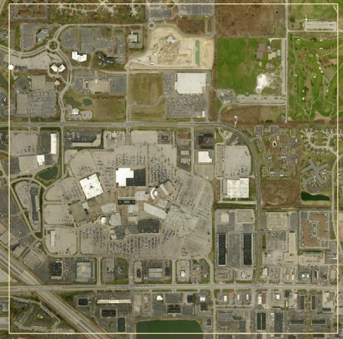
This is a square mile in the Castleton Area:

This area is not far from the proposed Northeast Corridor, which as Curt Ailes astutely pointed out, is not very dense. Notice almost all of the buildings are commercial in nature. Of course the roads are congested, there’s simply no other way to get around than by car. The dwellings are all on the periphery. Suffice it to say, if the northeast corridor is intended to be a commuter train to downtown, few people will board who actually live within this square mile.
Congestion is just one of many issues with this type of development. All of the resource-heavy infrastructure for paved parking lots, sewer and water lines, and wide roads are an expensive drain on our city. It’s no wonder municipalities around the country are going broke.
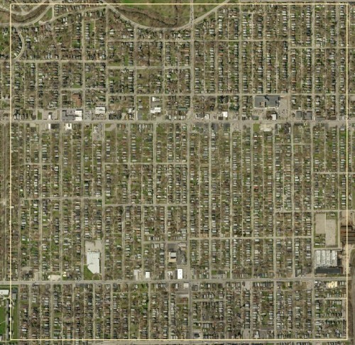
Now let’s look at a square mile in the heart of the East Side:
This square mile is not far from the proposed East Washington Street light rail line. The potential for transit ridership is about as high as it gets in Indianapolis. The walk or bicycle ride to the transit corridor would be direct and logical for most people, while reducing the need for expensive and land-heavy park-and-ride facilities.
Crafting transportation advancements based on traffic congestion ignores the greater problem with suburban development patterns. I hope that the MPO will figure this out before setting the Indy Connect plan in motion. I will still support Indy Connect as a rule, as the improved bus routing and frequency are too crucial to pass on. But I hope that it can also give us an awesome light rail network based on housing density and sidewalk networks.

Amen, Kevin. Why not put back light rail (in streetcar form) in neighborhoods originally built around it? Those neighborhoods still provide the bulk of IndyGo bus ridership, and have a good mix of uses that would drive 16-18-hour (if not 24-hour) activity on the lines.
Unfortunately, I can see the Northeast Corridor rail as just replacing congestion along I-69 leading to downtown with congestion along I-69 leading to Fishers. It’s just shifting the terminal destination without actually solving any of the congestion problems.
The Urban Land Institute conference was *extremely* interesting, and they heavily emphasized that any and all transportation planning needs to coincide with and be supported by transit-appropriate land use planning. Without change the built environment, you’re not going to change how people act inside that environment.
I wonder whether traffic congestion pricing would ease the problems associated with the northeast side?
Interesting that you didn’t mention, the orginal square mile, the Mile Square of downtown, bordered by North, South, East, and West Streets. Personally, I’d like it if downtown were refered to as the Mile Square more often (like the Loop in Chicago or French Quarter in New Orleans) than just downtown. Though it is interesting to see the square mile applied to the Castleton area, I don’t see too many people living in that square mile.
You could almost say the same for the original mile square of downtown, as the article is trying to point out the density of residential for mass transit to work…